YUCATÁN CENOTES
The elusiveness of water has always marked life in the Yucatán. There are no surface rivers anywhere north of Champotón, on the west coast, and the Belize border on the east. Rainwater sinks straight through the rock, and the Yucatán is honeycombed with caves and sinkholes (cenotes), including the longest underwater cave systems in the world. These majestic water-filled caverns are deep pools formed when the limestone surface collapses, exposing water below.Cenotes and the Yucatán’s caverns are magical places, and have always had great significance for the Maya, particularly associated with the rain god Chac. At his first sight of a cenote, early explorer John L. Stephens raved about ‘a spectacle of extraordinary beauty…a bathing place for Diana and her nymphs.’
Tulum village, just inland, was one of the most traditional Maya communities in northern Quintana Roo until the 1990s, but is now an untidy little town developing fast to service the burgeoning tourist trade.
South of Tulum, the beach road continues south to enter the 500,000-hectare (1.25 million-acre) Reserva de la Biosfera de Sian Ka’an $ [map] , a vast, scarcely inhabited expanse of tropical forest, mangrove swamps, reef, and wetland lagoons, which nurtures 300 species of bird and an abundance of such animals as jaguars, pumas, white tail deer, crocodiles, tapirs, and monkeys. Day tours, including boat trips through the lagoons, run from Tulum. The access road is unpaved from partway down Tulum beach and in the preserve, and often has basin-sized potholes, particularly after rain.
Cobá
From the main crossroads in Tulum, an almost straight, monotonous road leads to Cobá, 45km (28 miles) to the northwest, toward Valladolid. There are a few villages and several cenotes on the way. Many examples of Maya homes can still be seen, constructed in the traditional way on a base of stone with upright poles (Y-shaped at the top) supporting branches covered with palm leaves. These roofs shift and shake during hurricanes but, unlike some more solid structures, usually stay in place. Maya houses stay cool, too, aided by always-open front and back doorways and a breeze blowing between the poles.
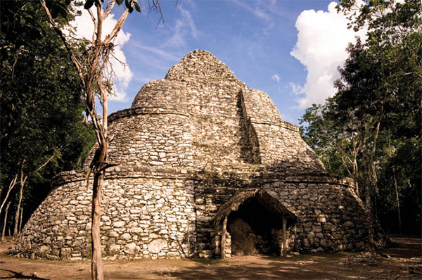
The pyramids and temples at Cobá % [map] (daily 8am–6pm) are widely dispersed around the forest, so exploring the site involves a fairly long walk, surrounded by greenery and the sounds of tropical birds (bicycles and tricycle-taxis can be rented at the entrance to make things a little easier). En route you might be able to admire the delicate flights of butterflies and orioles. Toucans and snakes are rarely encountered here, but crocodiles are quite easy to spot in the lakes – so resist the urge for a dip.

Cobá ruins.
Alex Havret/Apa Publications
Campeche and Chiapas
Filling the southwestern corner of the Yucatán, the state of Campeche is the least-known part of the peninsula, and still devotes as much energy to its fishing and oil industries as to tourism. The main draws here are the magnificent Maya sites – some still only partly uncovered – and the highly atmospheric walled city of Campeche. Champotón marks the site of the Spaniards’ first landing on Mexican soil (after their brief landing on Isla Mujeres), under Francisco Hernández de Córdoba, on 20 March, 1517.
The adjacent state of Chiapas to the south has a huge allure thanks to its superb Maya sites: Bonampak, Yaxchilán and, above all, Palenque, with graceful temple pyramids in a jungle setting. In contrast to the pancake-flat Yucatán, much of Chiapas is covered in forested mountains, with crystalline rivers and sparkling waterfalls gushing down steep gorges. It is home to over a million Maya, from eight different main groups, each retaining its own culture and language.