LA RUTA LENCA
A string of Lenca villages outside of the highland town of Gracias, each with an impressive colonial era church, have banded together to market themselves as La Ruta Lenca. Surrounding Celaque National Park, a circuit pieced together by mostly rough, unpaved roads connects the mountain villages of La Campa, Belén Gualcho, San Manuel de Colohete, San Sebastián, Corquín, and Mohaga. In each town you are rewarded with an unspoiled adobe village where an artisan or two specializes in Lenca crafts, such as the iconic black and white earthenware ceramics. Sundays are the best day of the week to come, when families come to town to sell produce and socialize, and churches are open. In La Campa, one of the first villages, the Centro de Interpretation de Alfarería Lenca (officially open daily 8am–8pm, but in reality hours are more flexible) gives some background on the significance on Lenca pottery, especially the giant urns called cántaros that the village is known for. From La Campa the road gets too rough to drive without a 4×4 and slowly winds its way to a fork. Take the road to San Manuel de Colohete, where you’ll find the area’s most impressive church, with a facade from 1721 and frescoes and altars that date back more than 400 years. A lively outdoor market is held on the 1st and 15th of every month (6am–noon).
Northern Honduras
With smart new beach resorts in Tela Bay and a growing number of North American retirees settling down, the North Coast has a sense of momentum that hasn’t been around since Standard Fruit entered the area. There are several important national parks, a good highway and all-around good infrastructure, while away from the zipline tours, Garífuna villages and Spanish forts remain to be discovered.

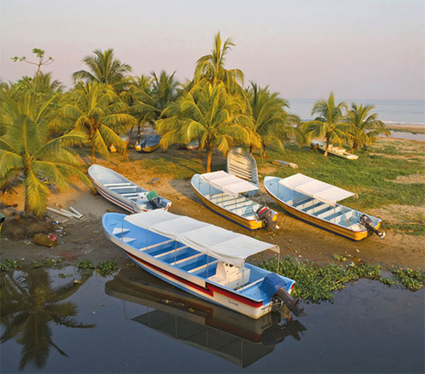
Boats moored up on Tela’s shores.
SuperStock
Tela
Conquistador Cristóbal de Olid founded the city of Triunfo de la Cruz on May 3, 1524, though its name was eventually shortened to just Tela @ [map] . Beginning in the early 1800s, the Garífuna came from Roatán and began settling here; many of their communities can still be found all around Tela Bay. For much of the 20th century, Tela was a company town, formed around the banana plantations of the Tela Railroad Company, a subsidiary of the United Fruit Company. When operations moved to La Lima in 1976, Tela took a hit. It wasn’t until the start of the next century, when plans were introduced to turn the bay into the next Cancún. Efforts were made to clean up the city and roads were paved through fragile ecosystems to the dismay of many environmentalists. The megaproject is still not fully developed and may never fully materialize, though a golf course and one luxury resort has opened.
Split in two by the Tela River, the city center is on the southernmost point of Tela Bay. Tela Veija, a small colonial grid with most city amenities, is to the east, while Tela Nueva, where the old Tela Railroad buildings and Telamar Resort (www.telamarresort.com), a hotel created from the skeletal remains of company houses, are to the west.
Roughly 5km (3.1 miles) north of Tela is the Jardín Botánico Lancetilla £ [map] (jardinbotanicolancetilla.negocio.site/; daily 7am–4pm), one of the world’s largest and most important botanical gardens. Established in 1926 by American botanist William Popenoe, Lancetilla was created so he could help United Fruit research and test new varieties of fruit, as well as treat diseases in the plantations. He brought in plants from all around the world, including the African Palm, which would eventually become a major cash crop, albeit a destructive one. The Honduran government took control in 1974 and now manages research here. From the visitor center, trails lead through the 1,680-hectare (4,151-acre) park, passing a large bamboo forest and hundreds of varieties of palms and fruit trees. Many visitors who come here are birders, taking advantage of the estimated 400 species that can be spotted, including trogons and toucans.
Outside of Tela
On the outskirts of the city around the bay are a string of traditional Garífuna communities, such as Triunfo de la Cruz to the east and Tornabé, San Juan, La Ensenada, Río Tinto, and lastly Miami to the west. Tensions have risen in these communities as the resort project as has been seen as a threat to their way of life; however, many are now employed by the resort. Miami, on a sandbar between a lagoon and the ocean, is the most interesting. It lacks running water and the residents still live in thatched huts, much in the same way they have for the last 200 years. For a small fee, local boatmen can paddle visitors out on dugout canoes or ride in motorized boats into the mangroves. The beach area is also quite pleasant and informal restaurants can prepare simple meals just off the sand.
Originally called Punta Sal, the 782km (484 miles) Parque Nacional Jeannette Kawas $ [map] was renamed after the environmental activist Jeannette Kawas Fernández, who was killed after establishing the park. Two distinct ecosystems are found here: the lagoon and the peninsula. Protecting the bay from strong winds called nortes, the peninsula is home to a combination of unspoiled coral reefs, dense jungle filled with howler monkeys, and stunning beaches. Los Micos Lagoon is separated by a small sandbar near Miami, and canals here weave through the rich landscape where hundreds of species of migratory birds can be seen. Outside of driving to Miami and hiring a boat to enter the lagoon, private transportation here is difficult. It’s recommended to use Tela-based tour operators like Garífuna Tours (www.garifunatours.com), which have regular trips to the lagoon and peninsula.
On the opposite end of Tela Bay is Punta Izopo, where the Lean and Hicaque rivers flow into the ocean amidst thick mangrove forests. Caimans, manatees, monkeys, and hundreds of species of birds can be seen. Kayak trips here are offered by Garifuna Tours, otherwise boatmen in the village of Triunfo de la Cruz west of the park will negotiate trips.
La Ceiba
The transportation hub of the North Coast is La Ceiba % [map] , the capital of the department of Atlántida. Fronting the Caribbean Sea and backed by the jagged mountains of Pico Bonito National Park, Honduras’ third largest city sprawls out along Highway CA-13, where Americanized malls and fast-food chains have firmly entrenched themselves. Two main avenues, San Isidro and 14 de Julio, run parallel to the beach and the city center, surrounding a leafy Parque Central, is not entirely without charm. Barrio La Isla, to the northeast is where you will find the Zona Viva, where the city’s best hotels, restaurants, and nightlife can be found. The city’s beaches tend to be polluted, so it’s best to go to the Playa de Peru east of the pier, or better yet outside of town, for bathing. More than a destination within itself, La Ceiba is better used as a jumping off point to explore nearby national parks or to catch flights and ferries to the Bay Islands.

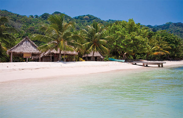
Tropical paradise on Cocalto Beach in Parque National Jeanette Kawas.
Robert Harding
Protecting the estuary of the Cuero, Salado, and San Juan rivers, the Cuero y Salado National Wildlife Refuge (daily 6.30am–6pm) is 30km (18 miles) west of La Ceiba. Rich with flora and fauna, sloths, otters, and white-faced monkeys, inhabit this mangrove ecosystem, best explored by boat from the visitor center at Salado Barra, where there is a café and dorm amenities. Omega Tours (www.omegatours.info) runs wildlife focused trips here that include about two hours on a boat plus transportation.

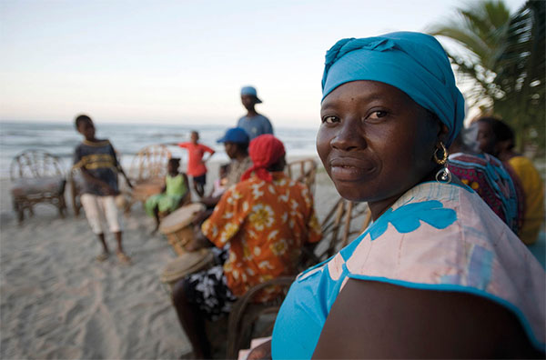
Garífuna people on the beach near La Ceiba.
Getty Images