Tobacco Reef
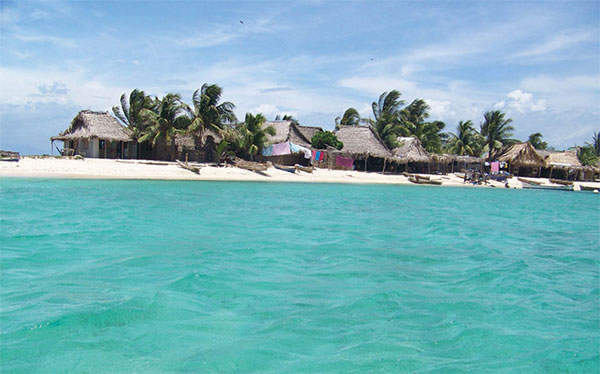
Some 20km (12 miles) offshore from Dangriga lie a row of tiny coral cayes, including Carrie Bow Caye, South Water Caye, and Tobacco Caye, all perched on top of Tobacco Reef like gems on a necklace. All are lined by perfect sands and dotted with coconut palms and can be easily reached in an hour’s boat ride from Dangriga. There are some beautiful clusters of coral in the shallow waters off these cayes, offering great snorkeling opportunities. In addition to the usual kaleidoscopic array of tropical fish, there is also a good chance of spotting moray eels, turtles, and nurse sharks.

Tobacco Caye.
Corrie Wingate/Apa Publications
The most accessible of the cayes in this area is South Water Caye · [map] , a small and beautifully maintained caye, with a superb array of accommodations, such as Glover’s Atoll Resort (www.glovers.com.bz), with breezy thatched cabañas on the beach, and a welcoming restaurant that serves fresh seafood; and Pelican’s Pouch Resort (www.pelicanbeachbelize.com), the sister resort to the Pelican Beach Resort in Dangriga, which is set on a gorgeous private beach, where you can swing in a hammock under palm trees, soaking up the sun.
Hopkins
While Dangriga is the largest Garífuna settlement in Belize, smaller colonies lie scattered farther down the coast, including Hopkins º [map] . It can be reached by sea from Dangriga across the Commerce Bight Lagoon, or from the west along a 7km (4-mile) road linked to the Southern Highway. The seashore at Hopkins is lined by scores of tall coconut trees sprouting from mountains of soft sand. Nets, draped over palmetto poles, lie drying in the sun beside fishing dories pulled up on the beach. Clumps of Maya-style homes – palmetto walls and palm-frond roofs – sit perched on stilts with magnificent views of the azure Caribbean to the east and jungle covered mountains to the west. Perhaps more than any other of the villages in the south, Hopkins has enthusiastically embraced tourism, with a growing number of guesthouses and cabañas, along with colorful restaurants, bars, and craft shops.
Eat
The versatile cassava is an integral part of Garífuna heritage, and is used for a variety of foods, including baked round loaves and, after mixed with ginger, sugar, and sweet potatoes, a favourite drink called Hiu.
Cockscomb Basin Wildlife Sanctuary
Seen from satellite photographs, the Cockscomb Basin looks like a huge meteor crater blasted from the center of the Maya Mountains. From closer to earth, it is a lush mountain basin, full of pristine tropical forest and riddled through with jungle streams. It has one of Central America’s densest concentrations of jaguars, and was the site of the world’s first jaguar reserve, the Cockscomb Basin Wildlife Sanctuary ¡ [map] (www.belizeaudubon.org; daily 8am−4.30pm). This rugged sanctuary supports a profusion of endangered wildlife. The bird list for the sanctuary stands near 300 species, including the brilliant scarlet macaw, the great curassow, the colorful keel-billed toucan, and the king vulture. The sanctuary is predominantly known to be a safe haven for the largest raptors, such as the solitary and white hawk eagles. Besides the jaguar, four other species of wildcat prowl the basin’s forests – the puma, ocelot, margay, and small jaguarundi. The signature howl of black howler monkeys has also returned to the Cockscomb Sanctuary, which established a new home for the baboons, as they’re called in Belize, in the early 1990s.

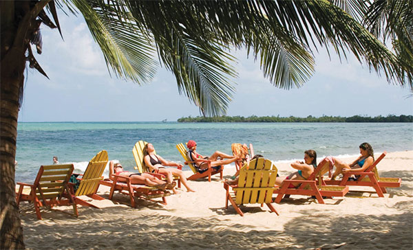
Relaxing on the beach at Placencia.
Corrie Wingate/Apa Publications
Placencia
In recent years, Placencia ™ [map] has become second only to Ambergris Caye as a coastal tourist hotspot, thanks to its sparkling sandy beaches, a vibrant social life, and a growing arts scene. The town is a mix of traditional wooden stilt-houses that are juxtaposed with an ever-expanding number of swanky new villas and hotels. Aside from the tourist boom, this is still a working fishing village, and the annual Lobsterfest in July celebrates both a bountiful harvest and fishing as a way of life. The Sidewalk Arts Festival, held in February around Valentine’s Day, is a popular showcase for artists from all over Belize.
Toledo District
The residents of the Toledo District, to the far south of Belize, often refer to their home as ‘the forgotten land.’ But it’s precisely the fact that Toledo is less touristed than elsewhere that makes it an exciting destination for adventurous travelers: This is a land that’s rich in primary rainforest, monstrous caves, and jungle-covered ruins. Outside of Punta Gorda, the only town of any size, restaurants are quite basic. The Toledo District is also, first and foremost, Maya country: more than half the population belongs to one of two Maya groups: Mopan or Kekchi.
Punta Gorda
Known locally as PG, Punta Gorda # [map] is the southernmost town in Belize, and is the capital of the Toledo District. These days, although the town receives fewer visitors than most other parts of the country, more people are venturing south to seek out the genuine atmosphere of a frontier outpost. The air is crystal clear here, possibly due to the annual 400cm (160ins) of rain continuously washing the dust from the air. Perched on a limestone escarpment, much of Punta Gorda lies only 4.5–6 meters (15–20ft) above sea level. The long, narrow town only stretches back a few blocks from the coastline, which slopes to pebbly, dark sand beaches where fishing dories lie pulled up on shore. Farther south, the Caribbean ceaselessly nibbles away at the land, dragging old houses and graveyards into the sea.
The pace of life is slow in PG, even by Belizean standards. The town is charmingly overgrown: huge mango trees tower majestically along the streets, providing welcome midday shade; flowering bushes and potted plants decorate the verandas of lichen-stained clapboard homes; and tall grass flourishes in most yards. That said, the town also has a good collection of accommodations and restaurants, as well as an excellent tour infrastructure in place – you can easily find quality guides to take you out to the Barrier Reef or on inland adventures.
Blue Creek Preserve and Hokeb Ha Cave
One of the most impressive natural sites in Toledo is the Hokeb Ha Cave ¢ [map] . The huge cave entrance is carved from the summit of a hill where the Blue Creek gurgles up from underground. After leaving the cave, the creek cascades over limestone boulders, under the towering shadows of the surrounding rainforest. Archeologists have found inside many Late Classic ceramics and an altar, leading them to theorize that the Hokeb Ha cave was used specifically for ceremonial purposes. The cave lies within the Blue Creek Preserve, a private sanctuary, with cabins by the riverside and various amenities, including an excellent canopy walkway strung between the trees, 24 meters (80ft) above the river.
Lubaantun
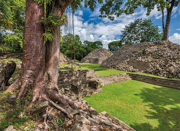
Lubaantun ∞ [map] (Place of Fallen Stones; 8am–5pm), one of the largest Maya sites in Toledo, lies high on a ridge above a valley cut by the Columbia River, near the village of San Pedro Columbia. The ruins were first excavated in 1915, and subsequent archeological study suggests that Lubaantun was built completely without the use of mortar; each stone was precisely cut to fit snugly against its neighbor. The slim, square-cut stones are one of the distinctive features of Lubaantun; it is also exceptional among Maya ruins for the complete absence of carved stelae, particularly in contrast with those of nearby Nim Li Punit.
Uphill from nearby Indian Creek village is the ceremonial center of Nim Li Punit (Big Hat; 8am–5pm), with splendid views and 26 stelae, eight of them carved, and among them the tallest ever found in Belize. The site’s name comes from a detail of a figure carved on one of the site’s stelae (Stela 14), which is the longest such ancient monument found in Belize. This stela, together with several others, is on display in the attractive visitors’ center at the entrance to the site.

The Maya site of Lubaantun.
Getty Images