Fact
The Lenca are the ancestors of Chibcha-speaking Indigenous Americans who came from Colombia and Venezuela more than 3,000 years ago. Today they number around 100,000 in Honduras and about 40,000 in El Salvador.
The country’s busiest airport is well outside of town and therefore many don’t even get a glimpse of the rather laid-back city center and all of the amenities it holds. The core of San Pedro Sula lies within the Circunvalación, a beltway lined with flashy malls, international chain hotels, and fast-food restaurants that give it the feel of a typical American city. In the very center of the Circunvalación is Parque Central, a rather quaint main square surrounded by restaurants and stores. A few blocks to the north is the Museo de Antropologia e Historia de San Pedro Sula (www.museosps.org; daily 10am–4pm), which has a chronological display of the region’s history from pre-Columbian times to the modern era.

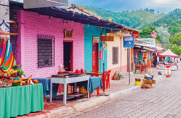
The charming streets of Valle de Ángeles.
Shutterstock
Farther north is the sprawling Mercado Guamilito (daily 10am–5pm) an excellent destination for exotic produce and handicrafts from all of the country, like Garífuna coconut carvings, Lenca pottery, and hammocks. Don’t miss the row of stands with women making tortillas and baleadas (a popular Honduran tortilla dish, folded in half and filled with mashed fried beans) by hand; a great photo opportunity.
Fact
The route from Lago de Yojoa to Copán is lined with quaint, colonial mountain villages and stands selling junco handicrafts. Many of the villages were founded in the 18th century by Jewish settlers from Spain, Marranos who were escaping religious persecution.
Lago de Yojoa
Surrounded by misty pine-covered mountains and coffee fincas, the 89 sq km (55 sq mile) Lago de Yojoa 4 [map] is a premier eco-destination that somehow isn’t swarming with tourists. It’s the country’s largest natural lake and a hotspot for birders who come from around the world hoping to glimpse some of the 400 or so species that have been identified here. Along the lakeshore are several fine hotels, which mostly attract Honduran families, and even a small craft brewery, the American owned D&D (www.ddbrewery.com), which also runs guided boat excursions on the lake. Along the highway bordering the lake are dozens of fish restaurants, selling freshwater fish that are fried whole and served with patacones (fried plantain).

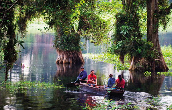
Boat on Lago de Yojoa.
Robert Harding
On the lake’s northern edge, 3km (1.9 miles) from the town of Peña Blanca, is Parque Eco-Archeological de Los Naranjos 5 [map] (daily 8am–4pm), a Lenca archeological site that dates back to approximately 700 BC. More interesting than the few mounds and piles of stones there are the 6km (4 miles) of stone paths, trails and observation towers scattered throughout the site where you can observe birds and other wildlife. A small museum and visitor center is at the entrance.
Covering 478 sq km (297 sq miles) along the rugged eastern side of the lake is Parque Nacional Cerro Azul Meámbar 6 [map] . The forested landscape rises to a height of 2,047m (6,714ft) and is quite pristine with waterfalls and elfin forests. Several hundred bird species have been identified here, including keel-billed toucans and resplendent quetzals. As few humans reach the higher altitudes, larger mammals like monkeys, jaguars and tapirs thrive here, though are not easily seen. There are three primary trails ranging from 1.2km (0.75 mile) to 8km (5 miles) that extend from the visitor center in Los Pinos. Guides can be hired at the visitor center.
Near San Buenaventura, about 10km (6 miles) from Peña Blanca, are the 43m (141ft) high Pulhapanzak Falls (daily 6am–6pm) on the Río Amapa. While few tourists visit, these thundering falls are plastered on tourism posters all over the country.
Comayagua
The capital of Honduras for more than three centuries before being moved to Tegucigalpa, Comayagua 7 [map] , 71km (45 miles) south of Lago de Yojoa, has the best-preserved colonial architecture in the country. Founded in 1537 by the Spanish explorer Alonso de Cáceres, much of the original city grid remains, along with palaces, churches, and squares.
At the north end of Parque Central, the Catedral de Santa María (daily 8am–6pm; free), dates to the late 17th century and is a masterpiece of colonial architecture. Four of the original 16 hand-carved wooden altars have been immaculately maintained. Outside in the tower, the clock dates to around 1100 and was built for the Alhambra in Granada but given to Comayagua by King Phillip III. It was originally placed in the Iglesia La Merced (daily 8am–6pm; free), four blocks to the south and the oldest church in Comayagua. It was built in 1550, but badly damaged in a 1774 earthquake and is partially reconstructed. Set in a 1558 building that once housed Central America’s very first university, the Museo Colonial de Arte (www.facebook.com/museocolonialdearte; daily 8am–4pm) maintains a collection of religious art and artifacts that have been created or donated to the city over the past five centuries.
Fact
During Comayagua’s Semana Santa, or Holy Week celebration, colorful sawdust carpets called alfombras are created by families, social organizations, and church groups and then during the Via Crucis Procession, they are trampled on and swept away.
Copán
Near the Guatamalan border is the Maya ceremonial city of Copán 8 [map] (daily 8am–4pm). The area around the ruins has been inhabited since at least 1400 BC. There were 16 consecutive kings who saw the rise and fall of the city, beginning with the Great Sun Lord Quetzal Macaw in 426 AD, as the history carved into the stone dictates. Adventurer John L. Stephens discovered the ruins in 1839, as described in his book Incidents of Travel in Central America, Chiapas and Yucatan (1841).
The town of Copán Ruínas is about 1km (0.6 mile) from the archeological site. Tourism runs the town and within a few blocks of the cobblestone plaza are dozens of small hotels, ex-pat restaurants, and handicraft shops. There are few attractions in town, other than the small Museo Regional de Arqueología (daily 9am–5pm), aka the Copán Museum, with some pottery and artifacts from the ruins.

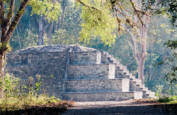
Gran Plaza, Copán.
Corrie Wingate/Apa Publications
On entering the grounds of the archeological site, a path leads to the claustrophobic Rosalia and Jaguar tunnels, which partially opened to the public in 1999 and are subject to an additional fee beyond regular park admission. The tunnels give an idea of how the Maya layered construction, building one temple over another. The trail continues to the Acropolis and Temple of Inscriptions. On the Great Plaza, diagonal from the Temple of Inscriptions, is where the city’s most important symbol can be found: the Hieroglyphic Stairway. Built by King Smoke Shell, the stairway features 64 steps, each carved with hieroglyphs that recount the history of Copán’s kings and their line of succession. Many of the carvings have faded and the necessary covering makes them difficult to make out, though collectively they read like a giant book. Carved stelae, originals, and replicas, beside the stairs depict various rulers and mythical beasts.