Belmopan
Founded in 1971, Belmopan ‚ [map] is the Brazilia of Belize: an artificial capital that has never quite caught on. Government departments are based here, but most politicians would rather commute from Belize City than take up permanent residence.
Belmopan has few historical monuments, and most of the buildings are administrative offices − in 10 minutes on the Ring Road, you can take in all the sights, including Market Square, which at any given moment is usually the busiest place in town: buses serving destinations all over Belize stop here and there are several banks and restaurants. Central American street vendors sell tasty corn and chicken tamales, and other local goodies.
Guanacaste National Park
Guanacaste National Park ⁄ [map] makes a good place to freshen up, right at the intersection of the George Price (Western) Highway. Not only does Guanacaste have magnificent trees and nature trails, but not too far from the main road there is an incredible swimming spot on the river. The current is very slow here as the water cascades gently over the rocks; locals wade right in with their clothing on, so there’s no need to miss the refreshing cold water just because you forgot a bathing suit. A bus from Belize City, Belmopan or points south can drop you right at the entrance to the park making it one of the most accessible natural reserves in Belize.

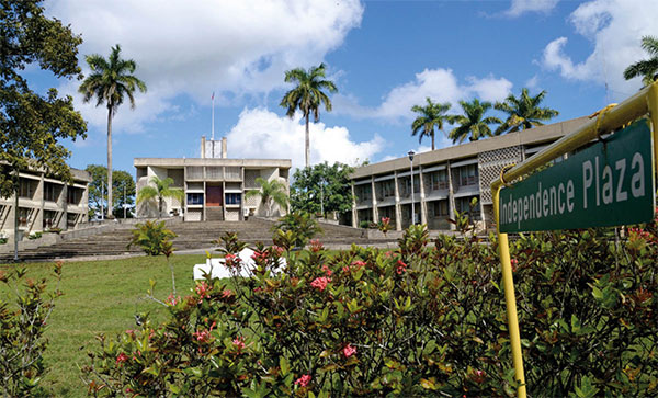
The National Assembly building in Belmopan.
iStock
Fact
The uses of the chicle gum tree, commonly known as the sapodilla, have been known since the days of the ancient Maya. It has long been used for medicinal purposes and continues to be manufactured into chewing gum to this day.
Blue Hole National Park
Heading west from Belmopan, 21km (13 miles) down the Hummingbird Highway is the St Herman’s Blue Hole National Park ¤ [map] . There is one entrance near the Blue Hole itself (at the bottom of a long flight of steps) and another at the visitors’ center near St Herman’s Cave. The blue hole is an astonishing sight: it’s truly blue, with just a touch of green at the edges of the 9-meter (30ft) diameter pool. The natural wonder is actually a collapsed karst sinkhole, estimated to be about 31 meters (100ft) deep. In the dry season the water is extremely cold because it is cooled by the underground limestone. The Belize Audubon Society (belizeaudubon.org) manages the park, which also contain more than 250 species of birds and other animals.
Cayo District
Cayo is the heart of Belize, embracing all the country’s landscapes and cultures and a perfect antidote to the heat and bustle of Belize City; the air is cooler, the people calmer, the pace gentler. And a short journey south from western Cayo into the Mountain Pine Ridge opens a world of environmental treasures here in the foothills of the majestic Maya mountains.
Cayo received its name after the Spanish word for cayes – coral islands off Belize’s coast – while San Ignacio itself is also known as El Cayo. The name may be a reflection of the isolation early settlers felt from the rest of the world before a roadway was first pushed through in the 1930s. Until then, boat trips to Belize City took about 10 days, horseback journeys anywhere from two weeks to a month.

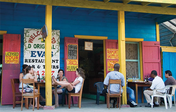
Eva’s restaurant and tourist information point, San Ignacio.
Corrie Wingate/Apa Publications
San Ignacio
Built in a spectacular valley, on the edge of a ravine above the Macal River, the town of San Ignacio ‹ [map] is separated from the neighboring village of Santa Elena by the Hawkesworth Suspension Bridge – a miniature model of the Brooklyn Bridge.
San Ignacio was the last frontier in one of the most obscure corners of the British Empire, and several of its buildings retain a faded colonial charm. The narrow streets are quiet to the point of somnolescence – although the combined population of San Ignacio and Santa Elena is around 14,000, making this the largest metropolis of western Belize. It’s worth timing your visit to be here for Saturday, when local farmers flock to the market with their produce.
San Ignacio is dotted with welcoming restaurants and bars, and also has a wide range of accommodations. It draws many international travelers and Belizeans from other parts of the country, which translates into a boisterous bar scene, particularly on the weekends.
Just off Buena Vista Road, around a mile south (1.6km) are the ruins of Cahal Pech (daily 6.30am-5pm), one of the oldest Maya sites in the area – it was populated around 1,000 BC until AD 800. The name means ‘Place of the Ticks’ – given in the 1950s when the area was used as a cow pasture. Various tour companies offer trips here from San Ignacio.
Mountain Pine Ridge Forest Reserve
The most popular excursion in the region is due south of San Ignacio to the Mountain Pine Ridge Forest Reserve › [map] . The sudden appearance of the pine forest, looking as if it is straight out of Vermont, is one of Belize’s more peculiar geological anomalies. Geologists explain that the unique granite base and nutrient-poor soil content of the area was either thrust up from below Central America countless millennia ago or was a Caribbean island that was effectively pushed on top of the rest of the isthmus during its formation. Actun Tunichil Muknal (also known as ATM) is one of the country’s grandest underground sights, consisting of a subterranean river with soaring chambers that are strewn with astonishing Maya archeological finds, including calcified skeletons of human sacrifice victims. ATM is only accessible via guided tour, the majority of which depart from San Ignacio or Belmopan; inquire at your hotel or the tourist office. One of the best ways to see ATM is Ian Anderson’s Caves Branch Adventure Company & Jungle Lodge (www.cavesbranch.com), where you can stay in wonderful treehouses, complete with hot tubs, and opt for a variety of adventures, including exploring ATM, rock-climbing, and more. At Green Hills Butterfly Ranch (www.greenhillsbelize.com; daily 9am–4pm; guided tours available, final tour 3.30pm), you can walk through a butterfly enclosure and view an impressive botanical collection.